It turns out there are actually people who live up this road, and one was coming out in his truck as I walked in. I remarked on him having a key to the lock, he replied that it makes things easier. Notice that I didn't put that in quote marks, I may have mis-remembered.
Here is a new feature, one that I shall not do again. It shows the route I walked, but it also shows the locations where I took most of the pictures. The numbers are not in chronological order, mind you!
And of course the sloppy green path is my walking route.

I walked about 2.7971 miles, which doesn't seem like much, and the difference between the lowest point (where I parked the vehicle) and the highest point is either 195 feet or 639 feet, depending on whether the map above is in feet or meters...
This panorama is from point 2. If you are going geocaching you now have a good idea of where the cache is.

These flowers, I took a picture of them as I was leaving the boulder area. You can see these flowers in the panorama above.

This picture of unfocused flowers was taken at point 5, which is where there is a road heading down to some houses, and there is a rusty old car sitting at the intersection. Maybe a Model A, or T, or something of that vintage. Are these California native plants?

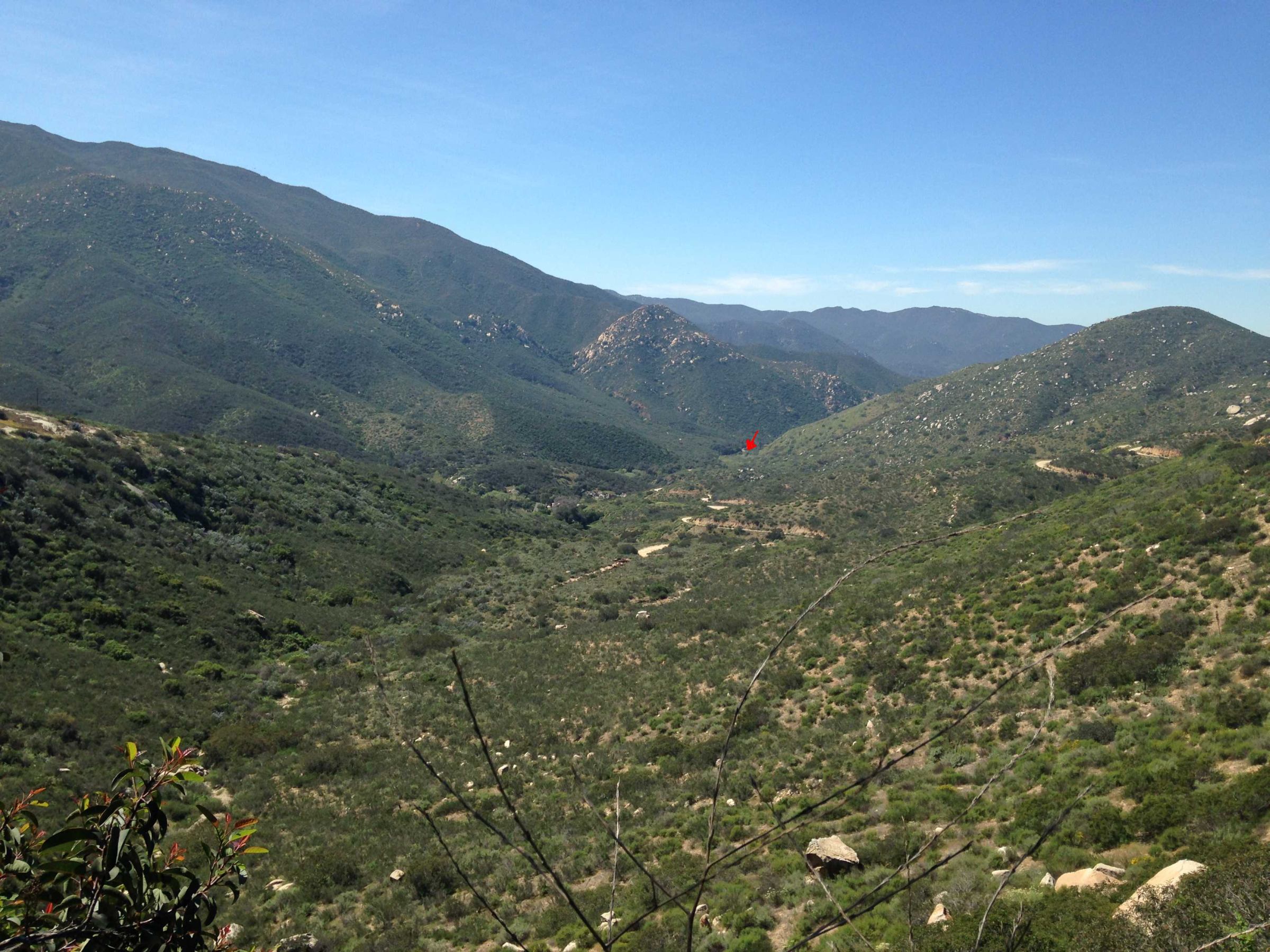
This was taken at point 7, as is the next photograph. That red arrow way down there is where I took another photograph looking back this way.
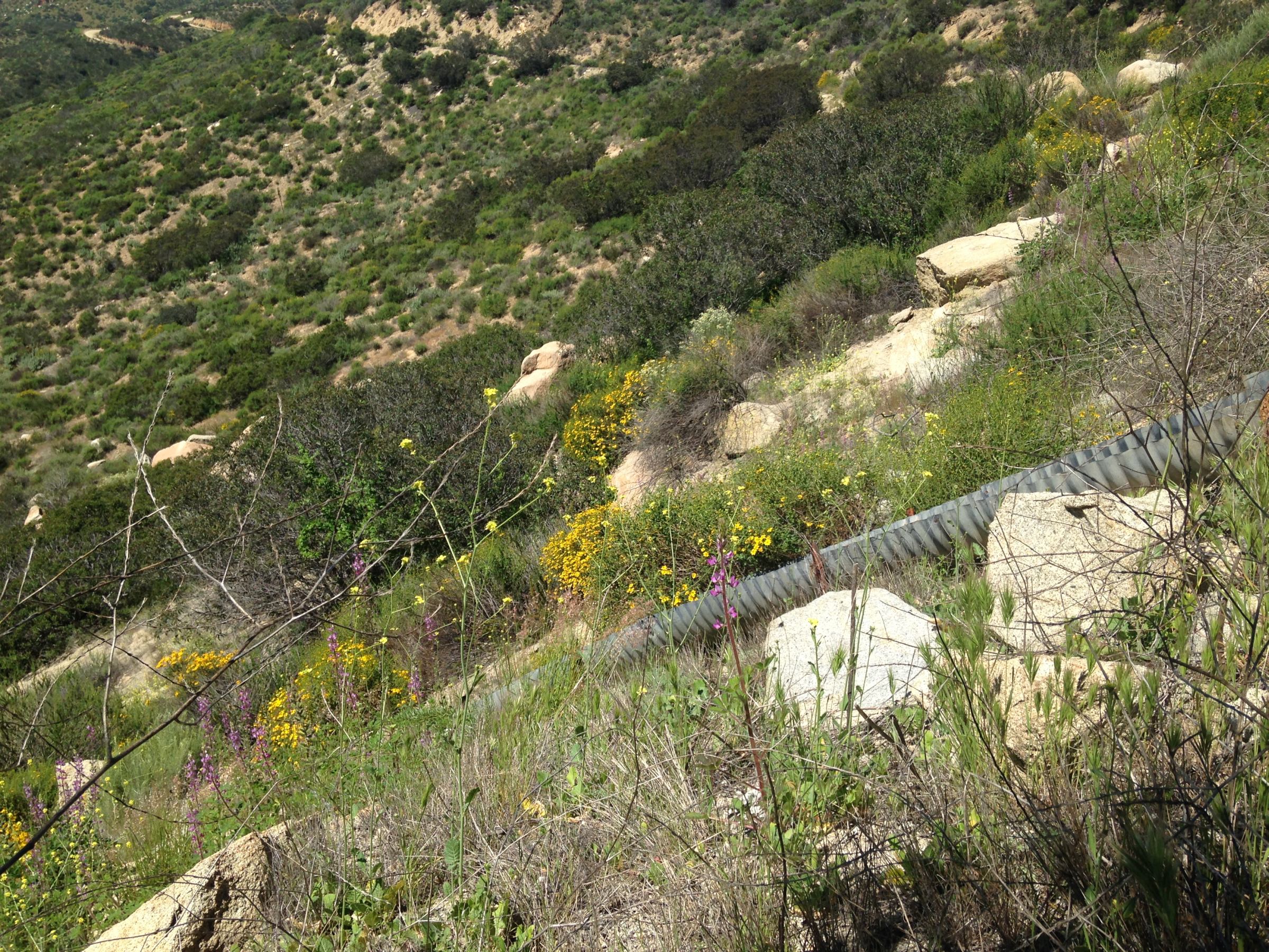
Who needs to go to the desert, there are plenty of wildflowers here! This picture was also taken at point 7.
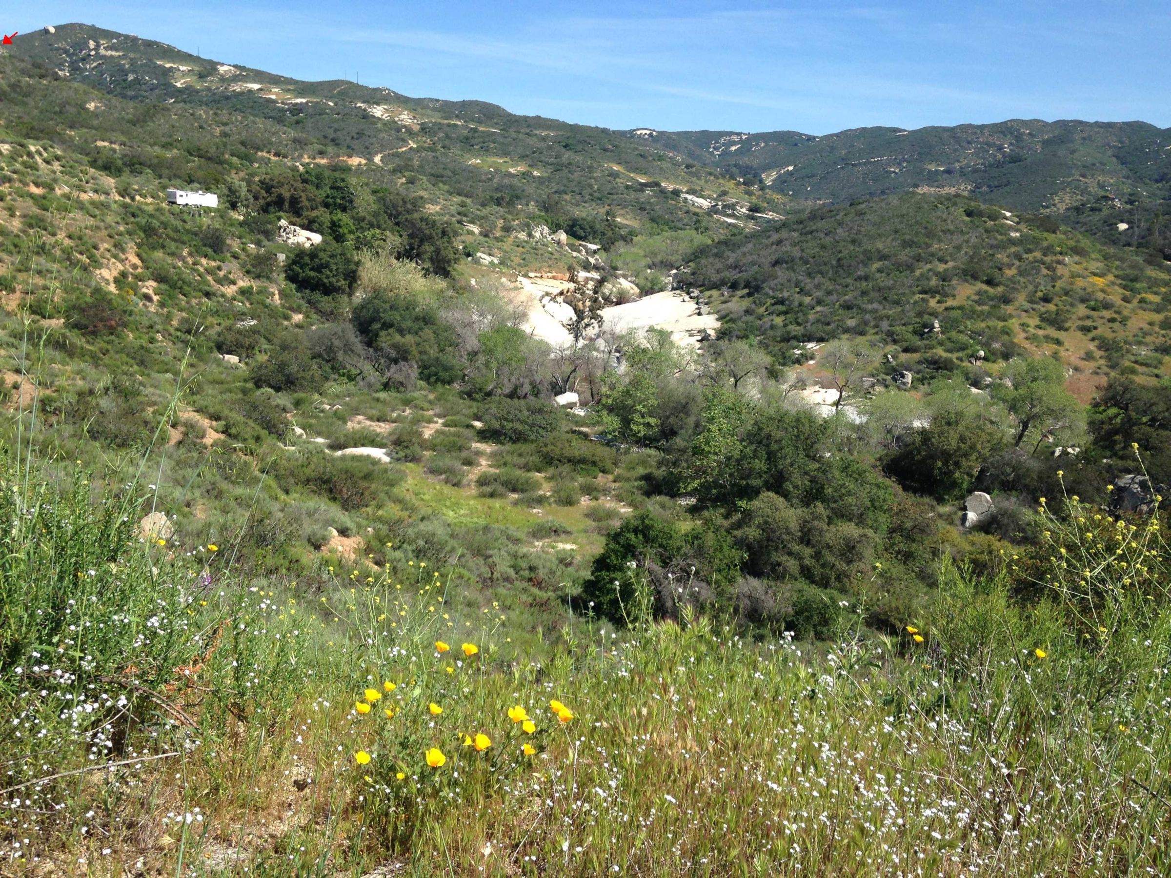
This picture was taken at point 4, and that red arrow in the upper left-hand corner is pointing at point 7. You can see some of the huge rock area that the Sweetwater River flows over. There are pools, too, but I'm sure they are on private land. At least, there is no access that I can see. You can see a house trailer that someone lives in. Nice view they have!
This one was taken at point 3, looking down the hill to where the Sweetwater River, or part of it, anyway, crosses the road. Most of the water goes under a decrepit wooden bridge that is posted with signs warning folks to stay off, as it is quite decrepit. I saw someone drive over it at the start of my journey...

I think this one was taken at point 3 also. It shows the reflections off water flowing down the mountains to the south.

When I got back to the vehicle (point 1) I was relieved to see my wallet was sitting right where I left it.

Driving back on Sloane Canyon Road I saw some people on the hillside. I figured them for geocachers, but it turned out they were looking at this big purple bush. The man took a picture of the woman, and I tried to not take picture of her, 'cause I'm polite, but she managed to still be in frame.

I think this is that "C" plant I can't remember the name of. I'm sure someone will tell me!

I think it is Ceanothus
Stuff I Want To Remember:
Sloane seems to be spelled both with and without the "e" at the end. Coast To Cactus used "Sloan", saying the "e" has been dropped over time, but the man the canyon is named after was Sloane.
I met a few (three plus one) bicyclists along the trail today. They were all participating in the Stagecoach 400 cycling event. That's 400, as in MILES. Whew!
While resting at point 6 I noticed a group coming down the California Riding And Hiking Trail from above. I went up that trail later, and on the way back down I met them coming up. They looked pretty tired. And hot. The boy looked pretty red, and didn't have a hat. I offered some water, but they said they had some. I told them I had parked at the bottom because I wanted to be going DOWN when I was tired. Coast To Cactus mentions parking at the top, maybe that is why they did. They didn't seem to know you could start at the bottom.
Thanks for reading!
1 comment:
And Google Maps says "Sloane", with an "e" on the end.
Post a Comment